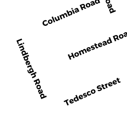
14 LINDBERGH RD
Owner Information
SLIWA K CHRISTOPHER
14 LINDBERGH ROAD
MARBLEHEAD, MA 01945-1125


Property Details
14 LINDBERGH RD is classified as a Single Family Residential (Colonial).
The primary structure on this property was built in 1938. There are 1,878ft2 of built area within this property. There is 1,878ft2 of residential/living space within this property. This property is listed as having 7 rooms.
14 LINDBERGH RD is valued at $616,800. The land is valued at $402,700 and the structures are valued at $209,100. There is an additional valuation of $5,000 on this property.
This property is in Zone SR. Confirm with local Zoning Board authorities to ensure there are no overlays or other easements on this property.
The most recent deed for 14 LINDBERGH RD is recorded at the local registrar in Book 10863, Page 83. 14 LINDBERGH RD was last sold on Tuesday, July 9, 1991 for $186,000.
Assessment data from fiscal year 2022.
Flood Data
According to the FEMA National Flood Hazard Layer, this property does not appear to be in a flood zone. It may also be in an area not yet reviewed. Nonetheless, confirm this information prior to taking any action.
To view the flood hazards around this property, create a FEMA "Firmette" Map of the area around 14 LINDBERGH RD.
Broadband Internet Providers
| Provider | Type | Bandwidth (mbps) | |
|---|---|---|---|
| Verizon New England Inc. | Fiber | 940 | 880 |
| GCI Communication Corp. | Satellite | 0 | 0 |
| Comcast | Cable | 1000 | 35 |
| Viasat Inc | Satellite | 100 | 3 |
| VSAT Systems, LLC. | Satellite | 2 | 1 |
| HughesNet | Satellite | 25 | 3 |
Broadband service provider data from December 2020.
Adjacent Properties
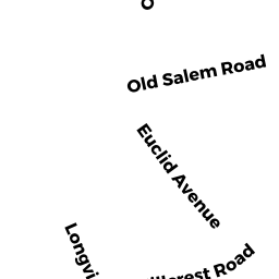
- 19 LONG VIEW DR
Single Family Residential owned by DUVEL WILLIAM A JR &LINDA TTES - 12 LINDBERGH RD
Single Family Residential owned by LUNDGREN KAREN E - 0 LONG VIEW DR
Undevelopable Residential Land owned by HIMMELFARB SHIRLEY ET AL-TRS - 16 LINDBERGH RD
Single Family Residential owned by HIMMELFARB SHIRLEY ET AL-TRS